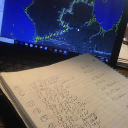
 One of the best places to begin route planning? Google Earth. Each day's travel length can be measured. Each proposed campsite's Lat and Long measurements can be recorded. Waterfalls can be seen, images from other adventures can be viewed. Imagine entering this area even, 120 years ago. Inaccurate maps and no information. Or, with a hand drawn map, a hunch and large sacks of flour, sugar, and salt. I can't fathom adventuring like the first explorers. Over-planning and information gathering can easily hinder the expedition prep process. Can't we just go already? If you're into adventure stories, check out Great Heart: The History of a Labrador Adventure. A 1903 ill-fated expedition into the unmapped Labrador Wilderness was a race for fame for Leonidas Hubbard that he would not survive. That gave way to a 1905 expedition crafted and completed by his wife, Mina Hubbard and her fantastic Cree Guide, George Elson. This expedition made headlines around the world. These days I can explore waterfalls, rivers and mountain tops around the world, in moments immediately after the thought occurs. Today I stood on the east face of Annapurna. Holy moly is that mountain steep. The world of adventure sure has changed in the last 120 years. I can take a flying tour of our expedition route at an altitude of 164 feet.
1 Comment
|
AuthorsBeth Jackson Archives
September 2018
Categories |
 RSS Feed
